Snap4City MultiDataMap is capable to show GIS data directly taking them from GIS servers providing data/info in WFS, WMS, etc. GIS servers provide this data according to some EPSG, in JSON and/or XML/GML.
The GIS data can be aquired from GIS servers to IoT Apps, and directly on Snap4City Dashboards.
From GIS Server WFS to Dashbaords
https://www.snap4city.org/dashboardSmartCity/view/Gea-Green.php?iddasboard=NDU4OA==
The task of this manual is to explain how to view features of a geographical entity retrieved by a WFS and showing them in a Snap4city dashboard in a WidgetMap. This feature allows you to view widget map data sets not taken from the devices, but from the web via WFS queries.
WFS (Web Feature Service) is a standard provided by the Open Geospatial Consortium (OGC) that allows users to query and retrieve vector geographic data called features (that can be viewed as points, lines or polygons) on the Web. Typically they retrieve data in a format gml, a markup language based on xml, but its structure can be very variable.
A query WFS to be integrated in a multidata map required these parameters.
mandatories:
- request
- getCapabilities = it can be used to retrieve a description of the WFS providing also a list of Features with their name.
- getFeature = provide the data of a feature.
- describeFeatureType = information about an individual feature type
- service= wfs
- typeName= [name of the feature] It must be used in addition to the request=getFeature parameter to obtain the feature data
- version = [it must be 1.0.0, 1.1.0 or 2.0.0]
optional:
- srsName: specify the system of coordinates. for example 4326 or 3003
- format: format of output data. For example application/json,
Example:
A useful way to create useful queries for the widgetMap is to first run a query with the parameter request=getCapabilities and search in the tags <FeatureType> and get the name of the feature.
https://wmscartografia.regione.marche.it/geoserver/it.regione.marche/wfs?request=getCapabilities
Get the data for the feature it.regione.marche:Sorgenti:
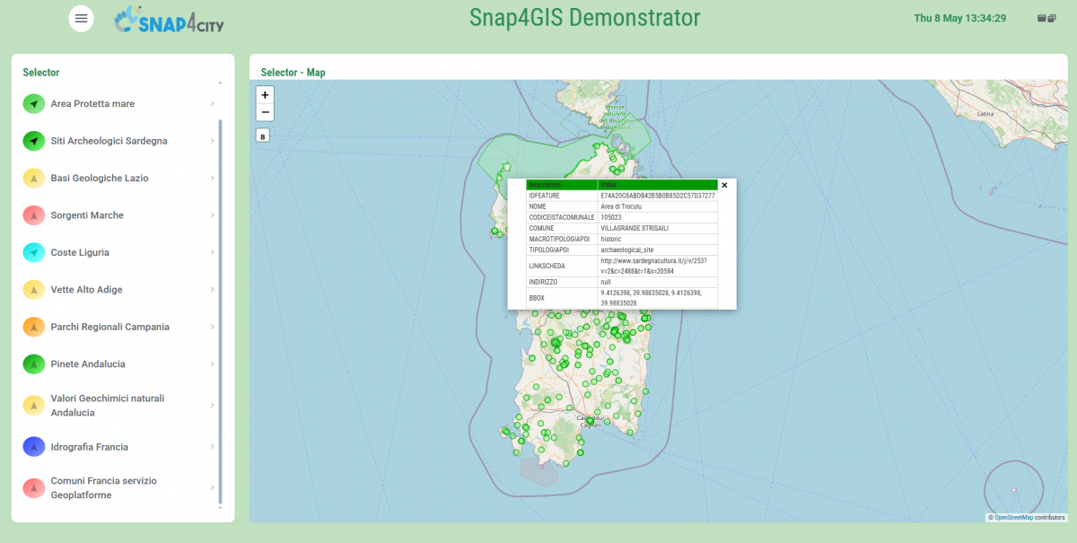
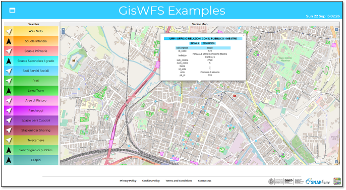
Selector Map
WFS APIs can be inserted into Selector widgets like other queries. Create a widgetMap and widgetSelector to call a WFS query and show it on the map. To be considered valid a WFS query must have the parameters:
- request
- typeName
- version
Examples:
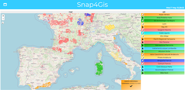
Point list: Arpav (Acronym of Agenzia Regionale per la Prevenzione e Protezione Ambientale del Veneto) is a public organization of the region Veneto which deals with environmental controls that protect the health of the population and the safety of the venetian territory. Specifically, this WFS API concerns the monitoring of phytoplankton along the Veneto coast, indicating the position of the monitoring stations via points on the map.
WFS API: https://gaia.arpa.veneto.it/geoserver/wfs/?request=getFeature&typeName=geonode:FITOPLANCTON_2017_2019_PER_STAZIONE1&version=1.1.0&service=WFS
Shape: This WFS api is about visualizing a series of shapes that concern the characteristics of the coast in the coastal municipalities of Liguria.
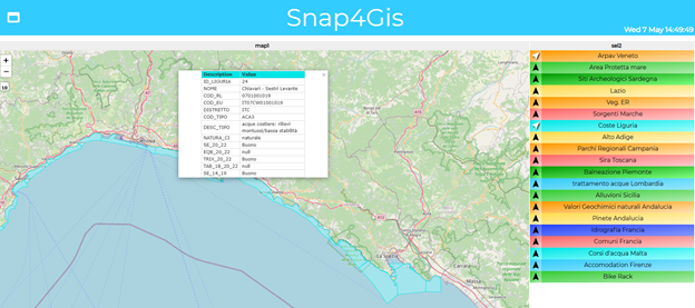
WFS API: https://geoservizi.regione.liguria.it/geoserver/M2644/wfs?version=1.1.0&request=getFeature&service=wfs&typeName=M2644:L10416
Notes:
- Popup layout and content is still provisorial and must be uniformed to the popup of markers
- Currently it works just with queries WFS who accepts the parameter format=application/json.
Interoperability at the large with GIS-based solutions
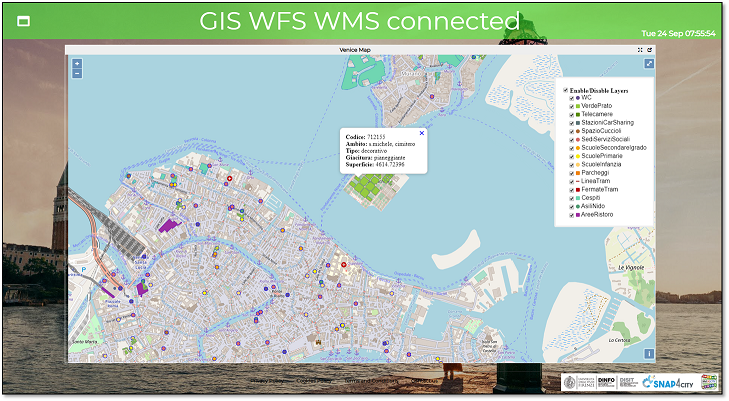
Snap4City can be easily connected with GIS solutions, for example ARGGIS, OpenGIS, QGIS, GeoServer, by using WFS and WMS protocols. Also Heatmaps and Maps of Snap4City are provided as WMS standard.

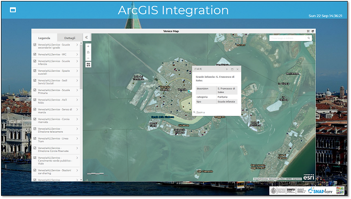
(B) GIS data on Dashboard via Snap4City GIS Player
(C) Dash with Snap4City GIS widget and Selector
Snap4City can use Selector to select WFS / WMS sources to be shown from ESRI ArcGIS (as well as from any other WFS service) on Widget map
The Snap4City Widget Map allows to mixt WFS GIS sources with Smart City API
https://www.snap4city.org/dashboardSmartCity/view/index.php?iddasboard=MTM5NA==
(D) Dashboard with Orthomaps and shapes layers based on WMS, GeoJSON
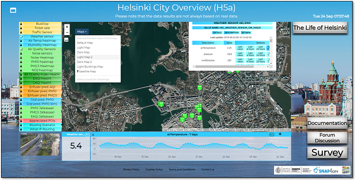
https://www.snap4city.org/dashboardSmartCity/view/index.php?iddasboard=MTQwNg
(E) Snap4City via WFS on top of Smart City API provide data to ESRI ArcGIS Enterprise or ArcGIS Pro, and thus the data become accessible on ArcGIS ESRI Portal
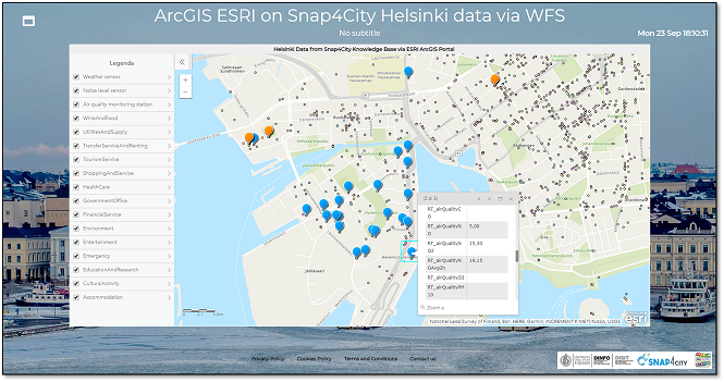
(EA) ArcGIS ESRI Pro as GIS / WFS play
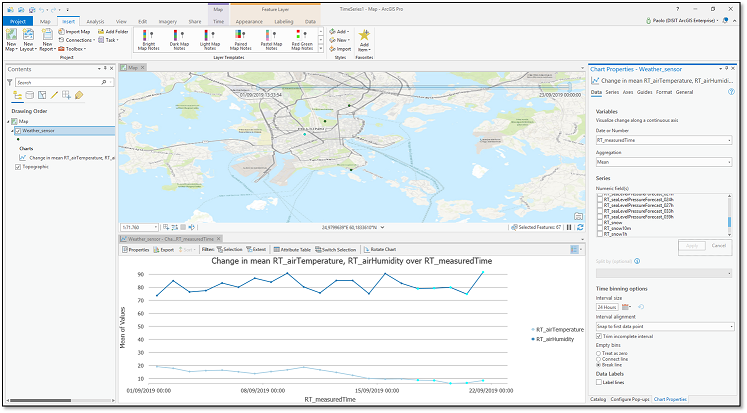
To test you need to have installed ArcGIS pro on your pc and connect with Snap4City WFS/WMF server or with ArcGIS server which has done the same connection with our server WFS/WMS
On PC:
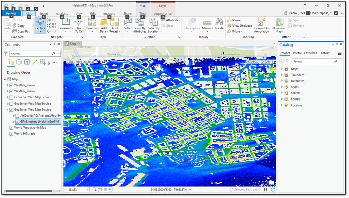
Heatmap taken from Snap4City GeoServer via WMS protocol
ESRI ArcGIS has an IOT solution based on ESRI GeoEvent, for real time data
In Terms of Data types


Snap4City is providing a special Widget for GIS connection that can be used in Dashboards.